
Bag a peak. Climb the highest point on the Port Hills and enjoy the 360 degree views.
| Start | Gibraltar Carpark, Summit Road, Port Hills |
|---|---|
| Finish | Ōmawete-Coopers Knob |
| Distance | 1.9 km |
| Time | 30 minutes one way |
| Toilets | The nearest toilets are located at the Sign of the Bellbird |
| Dogs | Dogs are prohibited from Ōmawete-Coopers Knob |
| Description |
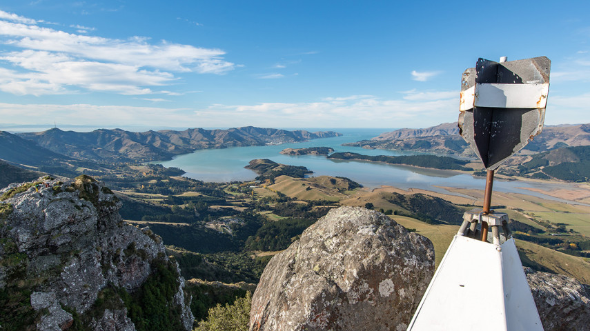
Ōmawete-Coopers Knob is the highest point on the Port Hills (573m) and offers panoramic views over the plains and up Lyttelton Harbour. You can pick up the track directly from Summit Road, just north of the Gibraltar Rock car park. The track circles the summit (which is a short detour from the Crater Rim Walkway and requires some easy rock scrambling) before heading back towards Summit Road and the car park. Get ready for this track using Plan My Walk(external link) by the NZ Mountain Safety Council. You can find track alerts, weather forecasts, trip reviews and a packing list, so you are set for your adventure. |
Walking tracks
Shared use
Connecting tracks
Closed

Parking

Bus stop
Toilets

Water fountains
Accessible tracks

Challenging feature

Entry and exit point

Point of interest
Related news

Council fixes te reo Māori signs
It’s time to say haere rā to incorrect spelling of te reo Māori signs at Christchurch and Banks Peninsula parks.
16 Sep 2026
Recognising guardians of the land
Paul Tamagushiku has protected, nurtured and cared for Christchurch parks for 38 years – earning him the title of the Council’s longest standing ranger.
31 Jul 2026
Ready, set, play! Exploring our city's playgrounds
Get the kids outside these school holidays and check out some of the great playgrounds around the city.
13 Jul 2026