
The timing and severity of sea level-rise impacts will vary across the district, so we’re doing our adaptation planning in stages.
Next adaptation area confirmed
Later in 2026, we'll begin the first phase of the next adaptation planning process, in the Lower Ōpāwaho Heathcote to Taylors Mistake area.
This area was identified based on coastal hazard risk, the number of public and private assets exposed to future flooding and coastal erosion, and feedback from communities about their readiness to take part in adaptation planning.
Read the announcement(external link) and the report to the Policy and Planning Committee(external link).
We’re generally following the approach recommended by the Ministry for the Environment (MfE) in the 2017 Coastal Hazards and Climate Change Guidance for Local Government(external link), and modifying it where appropriate for Ōtautahi Christchurch's conditions. For a summary of the MfE recommended process and Dynamic Adaptive Policy Pathways (DAPP), read our fact sheet [PDF, 577 KB].
Our approach is also guided by the Coastal Adaptation Framework [PDF, 4.7 MB], which sets out how we work alongside communities and rūnanga to explore risks and develop locally relevant solutions. We use a community-led process supported by technical expertise and guided by shared principles of partnership, inclusivity, and resilience.
For each planning area, a Coastal Panel is appointed to lead the process. The Panel is made up of a diverse group of community and rūnanga representatives from the area, along with city-wide representatives.
The Panel undertook the following:
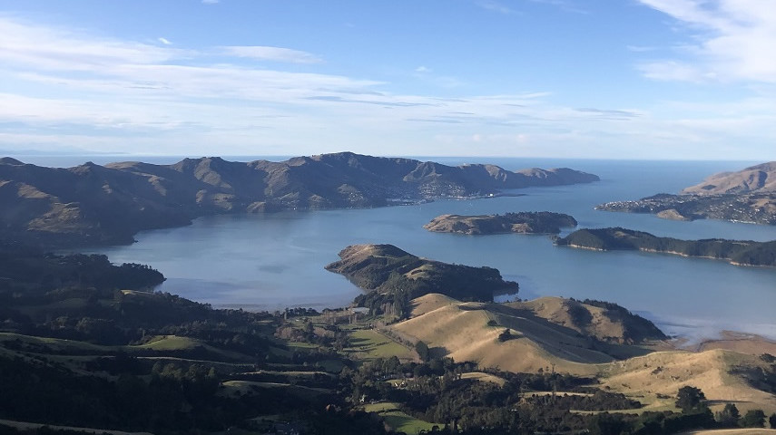
- Considered the cultural, social, environmental, built, physical and economic impacts of coastal hazards on communities across the Whakaraupō Lyttelton Harbour to Koukourarata Port Levy area.
- Considered the different opportunities and risks.
- Agreed on potential adaptation options and pathways for different assets in the area.
- Helped Council connect with community groups to support engagement reach.
- Considered community input alongside expertise from technical and specialist advisors, to make recommendations to the Council on preferred adaptation pathways.
For more information about the Coastal Panel and its role, read the Coastal Panel Terms of Reference [PDF, 811 KB].
The Coastal Panel had the support and assistance of a Specialist and Technical Advisory Group (STAG) - a forum that’s made up of experts in their fields. The STAG members provided information, advice and guidance to support the Coastal Panel's decision-making.
Council adopted the Coastal Hazards Adaptation Plan for Whakaraupō Lyttelton Harbour to Koukourarata Port Levy [PDF, 186 KB] in March 2025.
The plan focuses on six coastal communities, where coastal hazard impacts are projected to be most significant: Rāpaki, Allandale, Teddington, Te Wharau Charteris Bay, Purau, and Koukourarata Port Levy.
It outlines pathways for managing vulnerable public assets, such as roads, wharves, and water supply pipes, over the next 100 years. For each asset, there is a preferred pathway for adapting it over time, alongside the expected cost.
To ensure we are flexible over time as we see changes happening, there are also potential alternative options that can be used as required.
The planning undertaken by the Coastal Panel has provided the Council with an invaluable understanding of how we should be looking to adapt public assets to rising sea levels.
The process has also supported increased community awareness of coastal hazards and implications for public services and private property.
Now that the final plan has been adopted by Council, the focus shifts to implementation. Work is underway to develop a monitoring framework and to understand the roles of local, regional, and central government.
From October 2023 to January 2024, we asked for communities' feedback on the Coastal Panel's draft adaptation pathways for the Whakaraupō Lyttelton Harbour to Koukourarata Port Levy area, to check we were on the right track.
The draft pathways outlined different ways to address the risks from coastal hazards in the six priority locations over time. Read the engagement analysis [PDF, 114 KB] .
From October to December 2022, we heard from the wider Whakaraupō Lyttelton Harbour to Koukourarata Port Levy communities about what they value in their coastal environments, what they want the future to look like, and what they don’t want to see in the future.
This information was used by the Council and the Coastal Panel to ensure local values informed the development of adaptation pathways that allow communities impacted by coastal hazards to respond to changes over time.
To see the feedback we received from the wider community, read the full report [PDF, 1.8 MB] or the summary document [PDF, 471 KB].
In December 2021, as part of a scholarship project between the Council and the University of Canterbury, students undertook a survey to better understand communities’ risk tolerances and the impacts that the potential loss of main road access could have on residents and essential services in the area.
This information was also used by the Council and the Coastal Panel while making adaptation plans for the area.
To see the results of this survey, read the full report [PDF, 1.7 MB] or the summary document [PDF, 91 KB].
- Mahaanui Kurataiao Ltd's Coastal Narrative [PDF, 1.2 MB] – An overview of Ngāi Tahu's historical occupation and use of the coastal environment.
Sign up to our Whakaraupō and Koukourarata Coastal Futures newsletter