
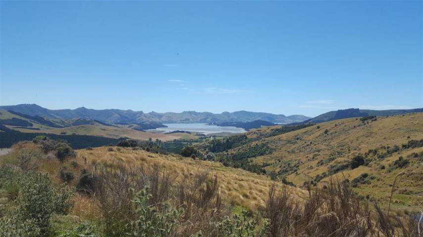
Enjoy stunning views of Whakaraupō-Lyttelton Harbour on this track to the historic Packhorse Hut.
| Start | Located a 30-minute drive from central Christchurch, this track can be started from a small car park near the crest of Gebbies Pass Road on the Lyttelton side. The track is marked with orange-topped poles. |
|---|---|
| Finish | Sign of the Packhorse Hut |
| Time | Approximately 2 hours, but this may change depending on the weather |
| Distance | 5.8 km |
| Dogs | No dogs. This is mostly private farm land. |
| Shared use | Yes, this is also a grade 4 mountain bike track. |
| Toilet | A non-flush toilet is available at the Packhorse Hut. Drinking water is also available here. |
| Description |
This track is part of the Te Ara Pātaka/Summit Walkway,(external link) and is one of three tracks leading to Packhorse Hut. This track is marked with orange-topped poles. From the car park, take the marked track below the logging road. Soon it crosses open paddocks with lovely views over Lyttelton Harbour/Whakaraupō. When you leave the paddocks and encounter the logging road for the second time, do not walk along it – make sure you cross over the road to enter the pine forest. The track climbs through the forest, eventually re-emerging into open land, then skirts below the Remarkable Dykes volcanic rock formations. The track ends at the historic Sign of the Packhorse Hut. There is a lambing diversion in place from August to October. Please follow all ground signage. Book a night at the nine-bunk hut(external link) via the Department of Conservation website, or continue on the Te Ara Pātaka-Summit Walkway(external link) to Hilltop. |
| Skills needed |
This track is suitable for people with moderate backcountry skills and experience. It's rough and steep in places, and pine logging in the area has meant that parts of the track can be muddy with fallen trees and branches nearby. The easiest of the three tracks leading to Packhorse Hut is Kaituna Valley to Packhorse Hut Track(external link), managed by DOC. This route is recommended for families with children and those new to tramping. |
| Other considerations |
The track is exposed to all weathers. It can be windy, cold and prone to low cloud in poor weather. The track can get very hot in summer, but nighttime temperatures may still drop lower than expected. Check the weather forecast before you head out(external link) |
Walking tracks
Shared use
Connecting tracks
Closed

Parking

Bus stop

Toilets

Water fountains
Accessible tracks

Challenging feature

Entry and exit point

Point of interest