
The Belfast Area Plan is a 35-year long-term plan to manage the effects of urban growth and development in the area.
Read the Belfast Area Plan [PDF, 3.9 MB]
It identifies development opportunities and provides a framework for managing the effects of this growth as well as locations of open space, water and transportation networks. The Belfast Area Plan was adopted by the Christchurch City Council on 24 June 2010.
The plan:
- Reflects how the local community wish the settlement to develop and grow.
- Ensures that growth is integrated with service provision, such as transport infrastructure.
- Seeks to remain consistent with the community’s evolving views.
- Outlines how the environmental values of Belfast are to be maintained.
Under the Greater Christchurch Urban Development Strategy (UDS)(external link), Belfast is identified as one of the two areas for accommodating future urban growth and development within greater Christchurch. The other area is South-West Christchurch.
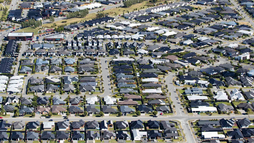
Belfast has undergone considerable growth during the past decade, changing the face of the community and putting pressure on existing community infrastructure and services. Belfast is now home to about 7600 residents, and this number is predicted to double by 2041 to some 15,000.
With this rate of growth, the Belfast Area Plan will ensure future development acknowledges the elements that the community recognises as important, such as parks, wetlands, special places, or significant buildings, and the treasured ecological areas like Styx River and Wilson's Swamp.
It will ensure that the development of the area fits with the existing community, protects the environment and recognises the special characteristics of Belfast.
The Plan was developed in consultation with the community and reflects how they want Belfast to develop. It provides a platform for planners, designers and developers to work together with the community to build an area which residents love to call home.
The Belfast Study area focuses on the urban settlement of Belfast and extends to cover some 1349 hectares. The southern boundary of the Area Plan runs along Styx Mill Road.
The eastern boundary follows the Northern Arterial designation from the north of Redwood, to the South Island Trunk Railway, and along the Railway to the Waimakariri River.
The western boundary starts from the Northern Motorway and follows the river terrace and stopbank running southwest, adjacent to the Otukaikino Stream and then south down Gardiners Road back to Styx Mill Road.
About 284 hectares of the area are zoned urban, 756 hectares rural, 172 hectares industrial, and 103 hectares are zoned open space.
View an A3 PDF version of the Belfast Area Plan study area [PDF, 2 MB] and physical constraints to growth.
The urban growth issues facing Belfast have been the subject of a series of studies in recent years.
- Basis for assessment [PDF, 879 KB]
- Natural values [PDF, 4.4 MB]
- Landscape values [PDF, 29 MB]
- Cultural heritage [PDF, 3.8 MB]
- Urban design [PDF, 13 MB]
- Land use scenarios and population projections [PDF, 2.5 MB]
- Business activity [PDF, 2 MB]
- Community facilities [PDF, 2.5 MB]
- Recreation and open space [PDF, 748 KB]
- Infrastructure [PDF, 6.9 MB]
- Rural resources [PDF, 2.7 MB]
- Constraints [PDF, 2 MB]
- Greenprint [PDF, 11 MB]
Building on these technical reports, a series of draft concept plans were prepared to indicate how these urban growth issues can be resolved and urban development managed to avoid adverse effects on the environment, infrastructure and the community. This work formed the development of the Draft Belfast Area Plan.
The Draft Area Plan was released for community consultation in late October 2009 and included a number of public information and feedback sessions. Submissions closed on 4 December 2009. A total of 111 submissions were received and generally indicated support for the concepts being proposed. A number of submissions, however, related to specific land holdings or ensuring that the Plan was flexible enough to accommodate regulatory changes that were already progressed.
The key themes within what were largely supportive submissions included:
- Support for the development of new community facilities.
- Support for reducing traffic volumes and encouraging non-motorised transport.
- Concern over the amount of proposed industrial land and its interface with residential areas.
- Support for public open space provision.
- Concern over the loss of productive farmland.
- Support for improving waterway health and flood management.
- Opposition to the extent of storm water management.
- Support for encouraging connections between neighbourhoods.
- Concern over consistency with existing and proposed statutory procedures, for example, Plan Change 22, Change 1 to the Regional Policy Statement.
- Opposition to whether the noise contours should limit development given existing residential development, for example Kaiapoi, within those contours, especially in consideration of the Regional Policy Statement Proposed Change 1 Decision which identified that area to the south of Johns Road.
- A request for balance when promoting indigenous vegetation over exotic vegetation.
- Clarification of the necessity for further schooling opportunities in the Belfast Area.
- Mahaanui Kurataiao Limited sought that all Goals in the Belfast Area Plan to be drafted in Māori and English, or only in English, and not just the Tangata Whenua Goal.
View the progress roadmap for the development and implementation of the Belfast Area Plan [PDF, 257 KB].
Plan implementation
Christchurch City Council adopted the Belfast Area Plan in June 2010, the framework to manage urban and business growth in the Belfast area of Christchurch. The plan covers about 1315 hectares of land and will be implemented progressively during the next 35 years in line with planned growth under the Draft Land Use Recovery Plan (LURP) and Urban Development Strategy (UDS).
Since the adoption of the Belfast Area Plan, Council staff have developed an Implementation Plan. This is a detailed programme of actions for the next three years to work towards achieving the objectives of the Area Plan.
Status of some key implementation projects:
- Rezoning of some land for development has been brought forward post-earthquake events and the Belfast Area Map from the LURP [PDF, 1.2 MB] shows status of land zoning for development and major infrastructure improvements as at September 2013.
- Implementation of the Styx River Stormwater Management Plan - Stormwater discharge consent was granted by ECan in June 2013.
- Northern Arterial Motorway planning in progress.
Styx River Stormwater Management Plan

Traditionally, stormwater has been discharged directly from pipes, concrete channels, boxed drains and pumping stations into the waterways, often carrying contaminants and other pollutants.
The new approach is to develop waterways in recognition that the natural environment is highly sensitive to the effects of land-use activity. Sealed surfaces, as an example, result in a greater risk of flooding and reduce surface water filtering into groundwater, placing our aquifers at risk. As new residential and industrial areas are developed around waterways in the Styx River catchment, these waterways will be assessed and where possible, be naturalised to improve water quality, better manage flood risks and enhance natural habitats.
Naturalised stormwater facilities will be built throughout the area, using sedimentation and detention basins, wet ponds, swales and wetlands to treat and manage stormwater run-off before it enters our waterways.